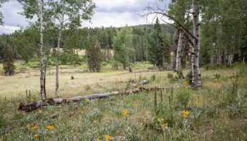
We’re counting down 11 days until we leave the Arizona heat, but this weekend, cabin fever almost got the best of us. To save our sanity, we headed up to the top of Mount Lemmon for some cold mountain air to tide us over. Today we hiked a new trail in a section we had never been in.

The Lemmon Rock Lookout Trail is actually part of the Lemmon Rock Loop, which if we had done, would have been an easy trail…. But why take the easy route when we’ve been loading up on chocolate chip cookies and need to burn the extra calories? So we descended 1,850′ then climbed right back up.
Husband must have eaten extra cookies when I wasn’t looking. Here he is trying to burn them off by carrying a large rock…
A split in the trail leads to either the Lemmon Rock Lookout Tower or the Lemmon Rock Lookout Trail. The Lookout Tower is just a short distance away from this sign and worth the extra steps. It’s closed to the public but right next to it is a viewpoint that offers awesome views.
Stairs to the lookout tower.
Hikers were once able to climb the stairs and head into the tower but this was closed a few years ago because it was too much of a distraction. It is a working tower.
And on to the Lemmon Rock Lookout Trail!
Beware the crazy, wilderness woman behind this sign!
This trail is clearly marked however, there are a lot of overgrown shrubs, large loose rocks, and downed trees that can make the descent slippery (my bum can attest to this).
Sweeping views of Tucson.
Views of the towering Lemmon Rock can be seen along most of the trail but the trail eventually leads away from it.
Lemmon Rock in the distance (far right).
Godzilla was a real trooper on this trail.
See the tiny Lookout Tower?
We were extremely pooped out when we finally made it back to the Lookout Tower. Cabin fever cured!
Lemmon Rock Lookout Trail Overview
- Coordinates: 32.44066111, -110.78591287 (Summit Trailhead)
- Fees: $5 (Interagency Annual Pass honored here)
- Difficulty: Strenuous
- Usage: Light
- Length: 5 Miles Out & Back
- Things to note:
- Trail is clearly marked but not well maintained. Lots of overgrown shrubbery, downed trees, and large loose rocks cover the trail.
- Tips:
- The descent back up Lemmon Rock Lookout Trail is very strenuous. For an easier option, do the Lemmon Rock Loop by continuing onto Marshall Sadle (1.7 miles) to Aspen Trail (1.3 miles) and connect back to the Summit Trailhead by finishing out .5 miles on the Powerline Road. Total is 5.5 miles, only about .5 miles longer than hiking the Lemmon Rock Lookout Trail out and back.
- Pets allowed: Yes
| How About You? |
|